Share False Creek Coastal Adaptation Plan on FacebookShare False Creek Coastal Adaptation Plan on TwitterShare False Creek Coastal Adaptation Plan on LinkedinEmail False Creek Coastal Adaptation Plan link
Consultation has concluded
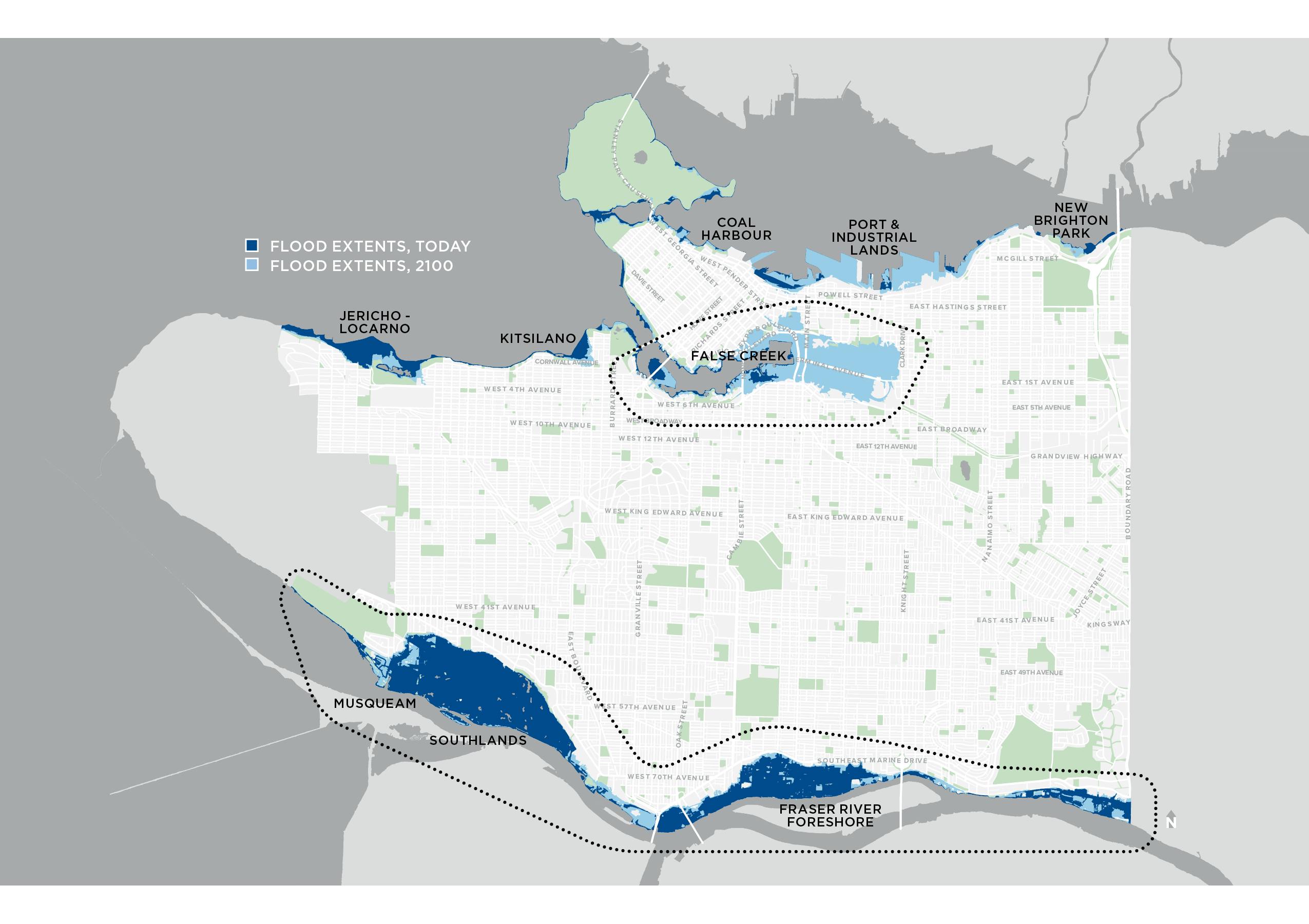
Thank you for your input and help as we plan and prepare for sea level rise. As a coastal city, our shoreline is changing with projections of about 50 cm of sea level rise over the next 30 years, one metre by 2100, and two metres by 2200. We've completed this phase of sea level rise planning in False Creek. There will be more to come in fall 2021.
Climate change poses many challenges for a coastal city like Vancouver, including rising sea levels and more frequent and intense floodingContinue reading
Thank you for your input and help as we plan and prepare for sea level rise. As a coastal city, our shoreline is changing with projections of about 50 cm of sea level rise over the next 30 years, one metre by 2100, and two metres by 2200. We've completed this phase of sea level rise planning in False Creek. There will be more to come in fall 2021.
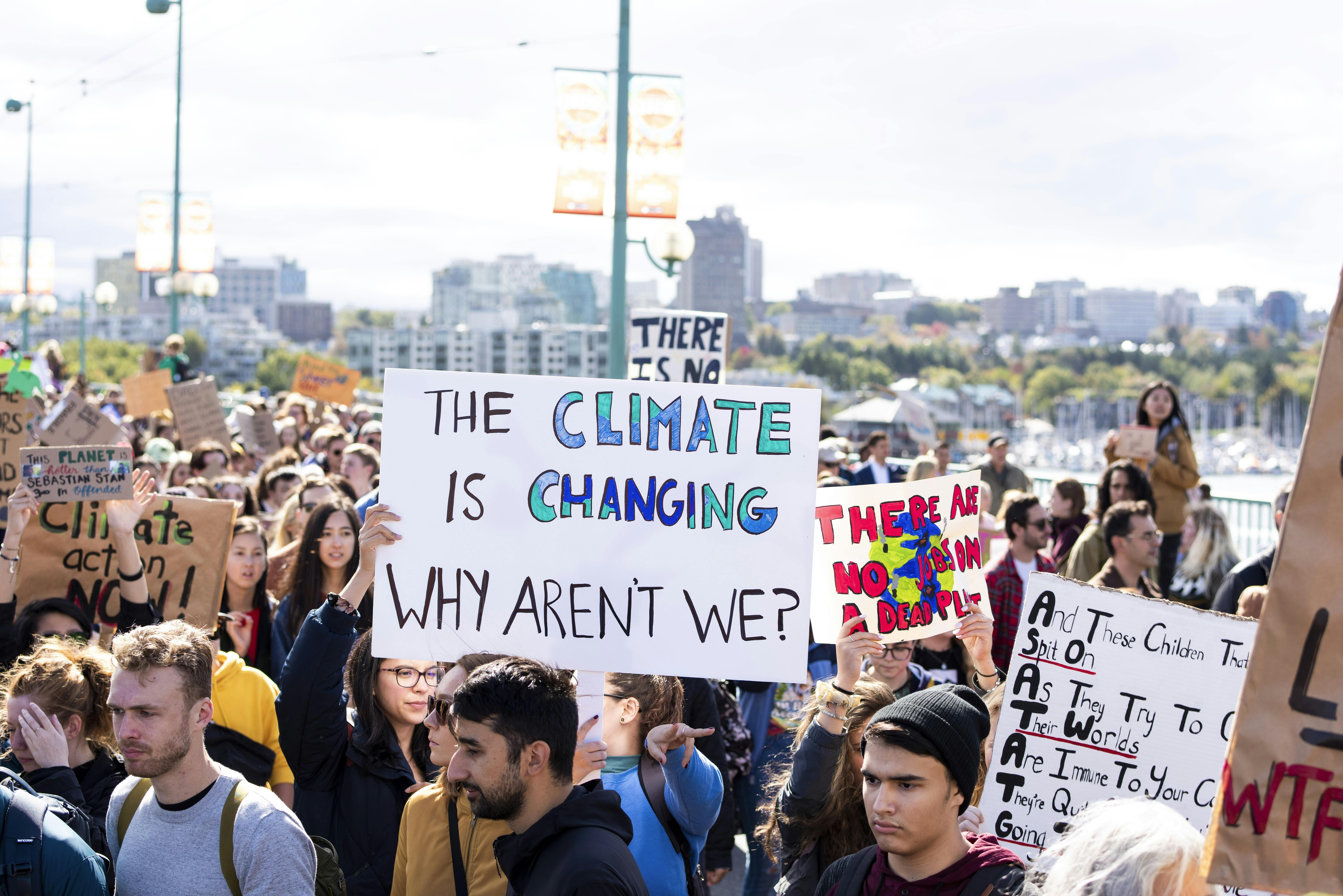
Climate change poses many challenges for a coastal city like Vancouver, including rising sea levels and more frequent and intense flooding along our shoreline and the Fraser River. If nothing is done, higher sea levels in the future will erode beaches, damage or destroy buildings and infrastructure in low-lying coastal areas, and permanently inundate some locations. Beaches and critical coastal ecosystems will be lost due to coastal squeeze. Vancouver’s current shoreline infrastructure is not designed to withstand these challenges, but we are working on a long-term planning effort to address these changes and build Vancouver’s climate resilience.
Help Shape False Creek's Coastal Adaptation Plan
The False Creek Coastal Adaptation Plan builds on work we started in 2018 along Vancouver’s Fraser River Foreshore. Today, work has shifted to False Creek where we are looking to engage residents, businesses, community groups and stakeholders this summer.
The first phase of community conversations, online engagement, and outreach will look to:
Increase awareness of sea level rise and coastal flooding risks for False Creek.
Explore and discuss community values for False Creek to understand what matters.
Introduce opportunities to avoid, reduce and prepare for sea level rise, as we plan our adaptation approaches to coastal flooding.
Explore and discuss flood management principles for False Creek to understand how we could and should prepare.
False Creek Coastal Adaptation Plan has finished this stage
January 2020
What we’ll do: Project research and planning.
Listening and learning
False Creek Coastal Adaptation Plan has finished this stage
June-September 2020
What we’ll do: Host community conversations, on-line engagement and a survey.
Who we'll engage with: Residents, businesses, utility operators, government agencies, xʷməθkʷəyə̓ m (Musqueam), Sḵwxwú7mesh (Squamish) and səl̓ilwətaʔɬ (Tsleil-Waututh).
Taking a deeper dive
False Creek Coastal Adaptation Plan has finished this stage
October-November 2020
What we’ll do: Host more conversations and, where possible, in-person activities to review and validate results.
What we'll create: A summary report to inform the next phase of our Coastal Adaptation Plan and the Sea2City Design Challenge.
Wrapping-up
False Creek Coastal Adaptation Plan has finished this stage
December 2020 - January 2021
What we’ll do: Consolidate feedback, share this information and prepare for next phase of Coastal Adaptation Plan and the Sea2City Design Challenge.
Final report
False Creek Coastal Adaptation Plan is currently at this stage
January 2021
The final outcomes of public engagement will be documented and shared, along with recommendations for future action.
Click here to play video
Meet Jade, a youth climate activist and Templeton high school student. Jade shares her perspectives on sea level rise and youth voices in climate action.
Click here to play video
Why is False Creek Important?
Meet Stephen, a professional diver and mariner, who has worked in False Creek for 20 years! Learn about every day life in False Creek.


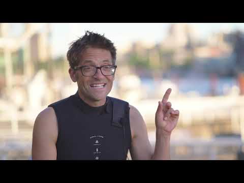 Meet Stephen, a professional diver and mariner, who has worked in False Creek for 20 years! Learn about every day life in False Creek.